Great sky view from the Guajara Mountain

The great sky view

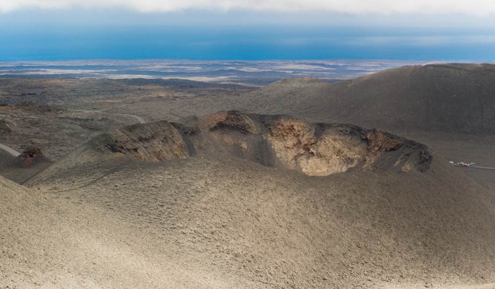
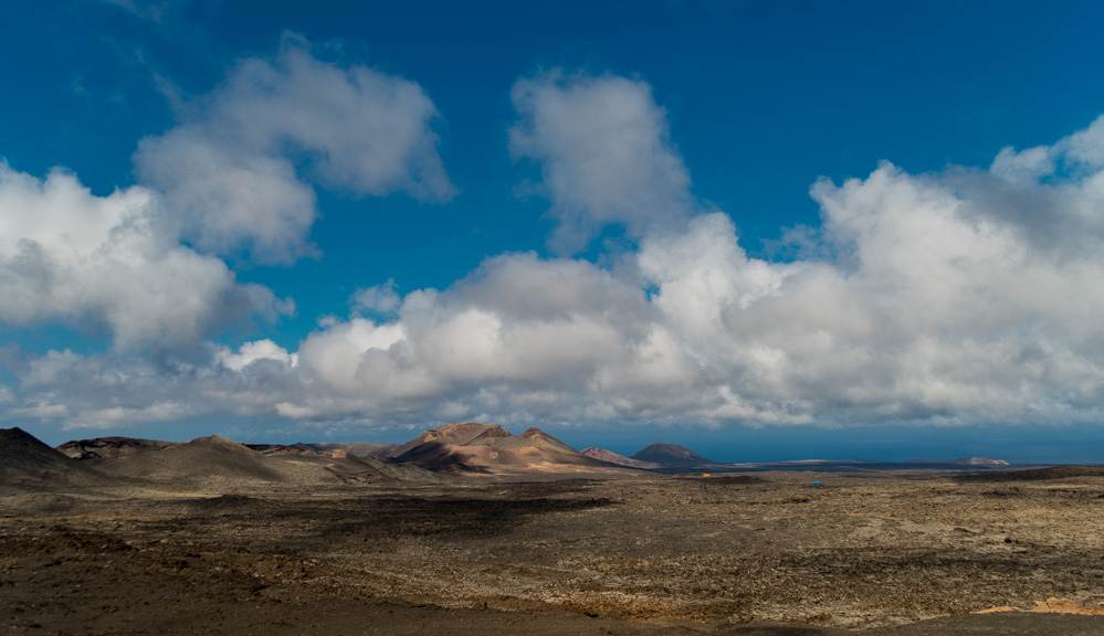
The great sky view from the top of the 2718m high Guajara Mountain over the Atlantic Ocean and the Canary islands. On one of the picures you can see Cran Canaria far away, on a nother the island of la Gomera. And you have also a great sky view over the Caldera Las Canadas. In my opinion the Guajara is a better place for a grat sky view on tenerife as the Pico del Teide. The Teide is higher but full of tourists with flipflops and shorts comming on top with the cable car. For this great sky view I backpacked my Kata photo bag with a ull frame and 4 lenses all the way up to the mountain by food. All for taking this grat sky view 🙂

Ich muß sagen mir gefällt die Aussicht vom Guajara aus wesentlich besser als vom Pico del Teide, obwohl dieser doch fast 1000 Meter höher ist. Auf dem Guajara hat man mehr Ruhe und es kommen einem nicht so viele Touristen in Flipflops und Hot Pants entgegen wie auf dem Teide. Vor allem sehr sinnvoll bei unter 10° 🙂 Aber da hoch gibt es ja auch keine Seilbahn, sondern man muß den ganzen Weg zu fuß bewältigen. Mehr über Stein als über Stock, und ab und zu recht harkelig, aber für ein gutes Bild oder eine gute Aussicht ist einem ja kein Weg zu weit. Außerdem hat man vom Guajara aus auch noch einen super Blick auf den Pico del Teide, und vor allem über die Caldera Las Canadas mit dem Pico del Teide als Hintergrund. Als Hobby Fotograf ist man ja das Leiden gewohnt, warscheinlich würde auch sonst niemand freiwillig sein ganzes Geraffel in einem Rucksack mit ganz bis oben auf die Spitze schleppen. Zusätzlich zum Wasser und dem Profiant. Aber man will es ja so 🙂

Anaga

The Anaga Mountains

Pictures from a hiking trip to Tenerifes beautyfull Anaga mountains. The Anaga mountains, a part of north Tenerife. You have a good view for the snowy peak of Pico Del Teide shere und over the north part of the island. The Clouds from the atlantic ocean moves over this part of the island and get down by the trees. So the view can change from bright sunlite to very much fog in under two minutes.

Das Wetter wechselt ziemlich schnell im Anaga Gebierge. Innerhalb von 2 Minuten hat man den Wechel von tollem Sonnenlicht zu sehr dichtem Nebel. Also ideal für Fotografen die gerne bewegte Wolken oder umher ziehenden Nebel in ihren Bildern haben. Sowas geht da gut, und es ist eine imemr grüne Gegend 🙂

Marina Rubicon

Marina Rubicon

Marina Rubicon. A nice and clean marina at Playa Blanca, the south side of the canary island Lanzarote. I was not there with a boat so I cant tell you any experience how good they are  with boats there, I was just there for sightseeing and for some traveler pictures. Turquoise water, white houses, blue sky an mountains in the background.


Trichoglossus Haematodus

Trichoglossus Haematodus

The rainbow Lorikeet ( Trichoglossus Haematodus ) or as we say in germany Allfarblori is a very colorfull and friendly little bird I met this birds on my last trip to the Canary island Tenerife at the Katandra Treetop. A big birds free fly compound in one of europas best zoos, the Loro Parque. And I only do this kind of pictures when I am on vacation 🙂 The birds there are very handsome For most of the pictures I used my old Sigma 105 macro lens. In the manual mode, because the autofocus is not very quick. Or should I say it is very slow 🙂


Timanfaya fire mountains

Montañas del Fuego – The Timanfaya fire mountain

The second part of my trip to the Timanfaya fire mountain (Montañas del Fuego). Its an national park vulcano area in the southwestern part of the island of Lanzarote, Canary Island. Ihe last big eruption was in 1824, and the biggest eruption was in 1730, when it covers half of the island with lava. And please dont miss the first part 🙂

Montañas del Fuego

The Timanfaya fire Mountain

Some impressions fom my trip to the Timanfaya fire mountains (Montañas del Fuego). Its an national park vulcano area in the southwestern part of the island of Lanzarote, Canary Island. Ihe last big eruption was in 1824, and the biggest eruption was in 1730, when it covers half of the island with lava.